Presented by the
Newfoundland's Grand Banks Site
to assist you in researching your Family History

Click on the graphic below to return to the NGB Home Page
Newfoundland's Grand Banks

To contribute to this site, see above menu item "About".

These transcriptions may contain human errors.
As always, confirm these, as you would any other source material.

District Photo Album
St. John's City Area
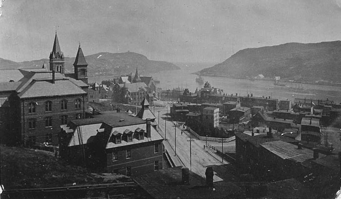
View down Long's Hill, St. John's

St. John's
c1906

A view from Harvey road looking down Long's Hill towards the Narrrows and Signal Hill, in St. John's.
Gower Street Methodist Church can be seen just left of centre, with the Anglican Cathedral behind it.
On the left of the photo is the rebuilt Methodist College, and St. Andrew's Presbyterian Church
"the Kirk", behind it. If you look carefully at the piece of land in front of the Kirk, you will
see 3 or 4 small white objects. These may be some surviving headstones from the
Old RC Cemetery that was destroyed in the Great Fire of 1892.

This is from an old album of my grandparents.

Contributed by Geoff Martin 2006 09

The Category Search Engines have been Discontinued
Due to Technical Problems
Please use the "Google Search" below,
pre-configured for the NGB Site

Page Last Modified Saturday October 07, 2006 (Craig Peterman)

Newfoundland's Grand Banks is a non-profit endeavor.
No part of this project may be reproduced in any form
for any purpose other than personal use.

JavaScript DHTML Menu Powered by Milonic

© Newfoundland's Grand Banks (1999-2008)

Hosted by
Chebucto Community Net

Your Community, Online!

NOTE:
You can search the entire NGB site
by using the [Google] search below.

Be aware that the 1921 files have been reorganized and may not return a valid address until Google catches up.
If you get an error message, go back through the menus and access the files through them. Files are all there and available for use.

Google
WWW ngb.chebucto.org
[Recent] [Contacts] [Home]